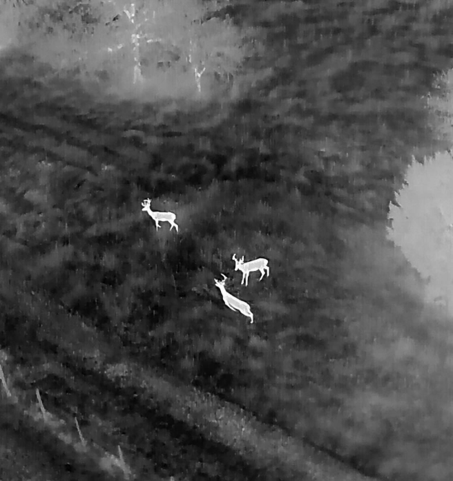
Vista Metrics provides non-invasive thermal drone surveys to support deer population assessment and land-management decision-making across estates, parkland, and managed woodland.
Using early-morning or dusk thermal flights, we help estates build an evidence-based picture of deer presence, relative numbers, and spatial distribution, without disturbance to animals or the public.
Estimated deer count ranges (not absolute claims)
Spatial distribution and movement patterns
Identification of key habitat use and corridors
Annotated thermal and visual imagery
A concise, defensible report suitable for internal use or consultant input
The approach is designed to complement existing deer-management and forestry practices, not replace them.
*Pricing based on 350 Ha site
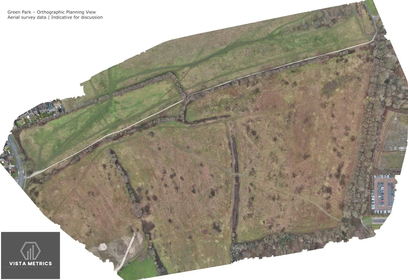
Our 3D drone mapping and orthographic mapping service provides high-resolution, georeferenced aerial datasets for construction monitoring, planning support, land visualisation, and asset documentation.
Using professional photogrammetry workflows, we produce orthographic images (orthomosaics) and scaled 3D site models that allow users to visualise sites, review progress, and extract indicative measurements such as distances, areas, and relative volumes. These datasets are corrected for perspective and distortion, making them suitable for technical review and comparison over time.
All outputs are non-survey-grade and are not intended to replace formal land surveying or engineering measurements. They are designed to support visual assessment, progress tracking, feasibility review, and stakeholder communication, where speed, coverage, and clarity are more important than certified survey tolerances.
We operate repeatable flight plans to support baseline site capture and ongoing progress comparison, enabling teams to clearly identify change, sequencing, and site evolution throughout a project lifecycle.
Deliverables can include:
high-resolution orthographic images
interactive web-based 3D models
point clouds and visual meshes
measurement-enabled files for planning and review
All outputs are supplied in commonly used formats suitable for project teams, consultants, and facilities managers.
Based in Leeds, we regularly carry out 3D mapping and orthographic mapping projects across Yorkshire and surrounding regions, typically travelling up to two hours where a site warrants aerial capture.
If you require a clear, objective aerial record of a site for monitoring, planning support, or documentation — without the cost and lead time of a formal survey — this service provides a practical and reliable solution.
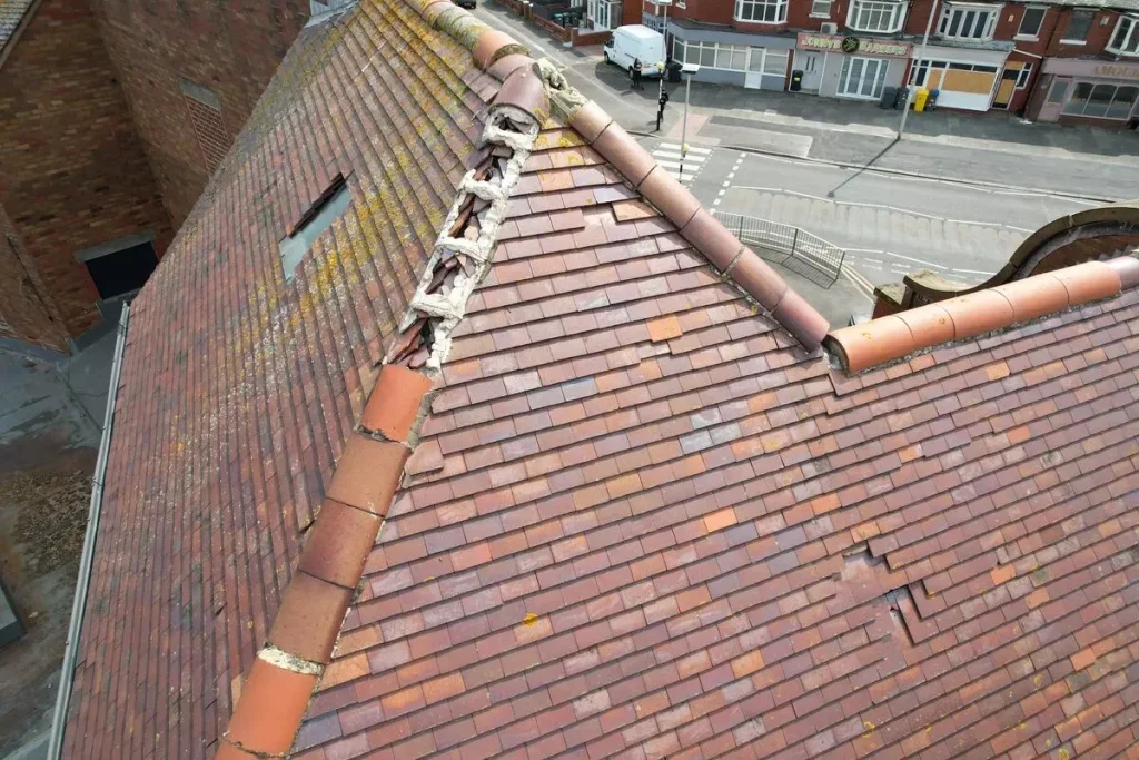
Detailed aerial inspections of roofs, chimneys, façades, gutters, and structural elements, delivering clear visual records without scaffolding or temporary works. Ideal for condition assessments, defect identification, and contractor scoping.
Improves decision-making while avoiding access costs and delays.
Entry Pricing based on a 3 bed semi-detatched.
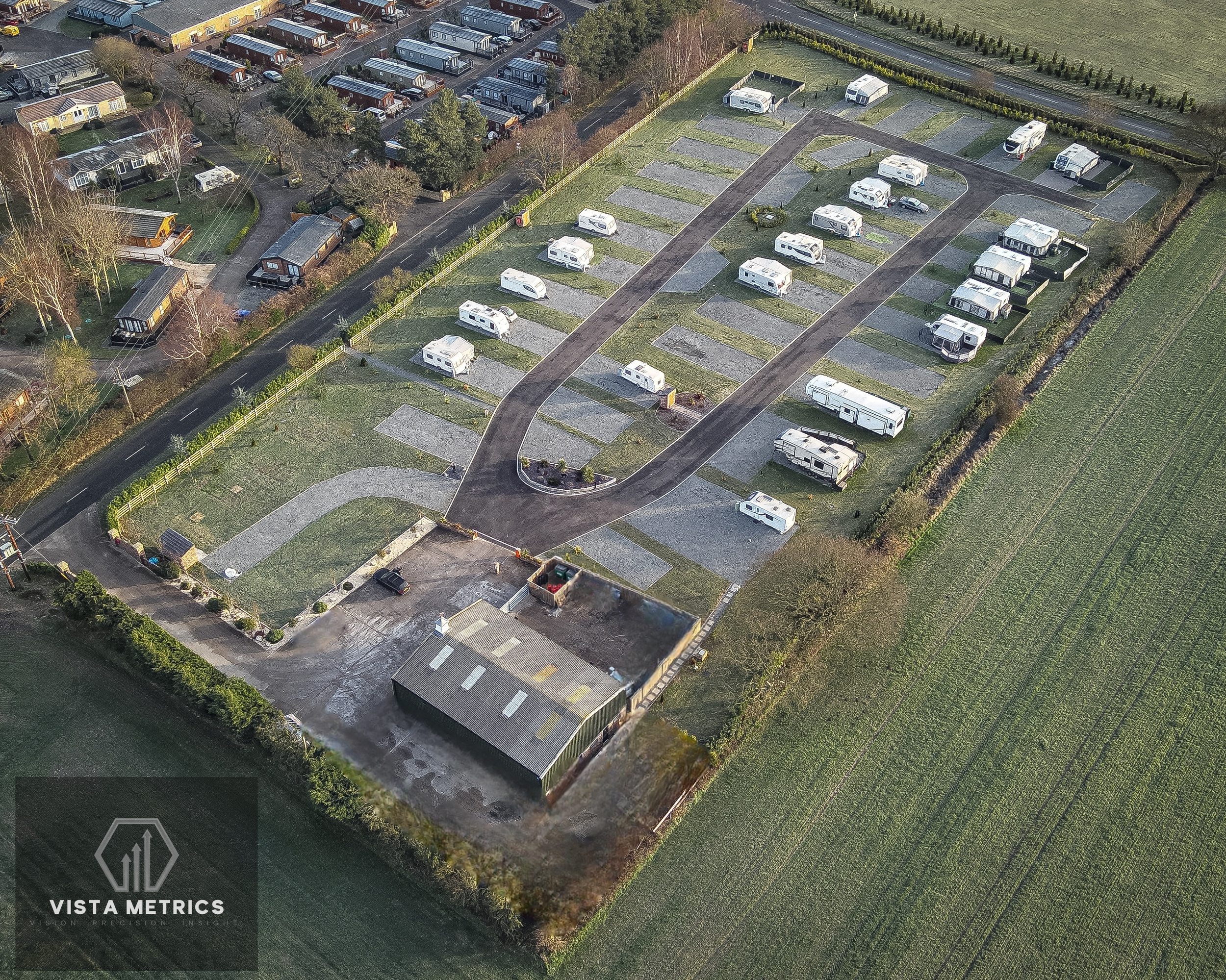
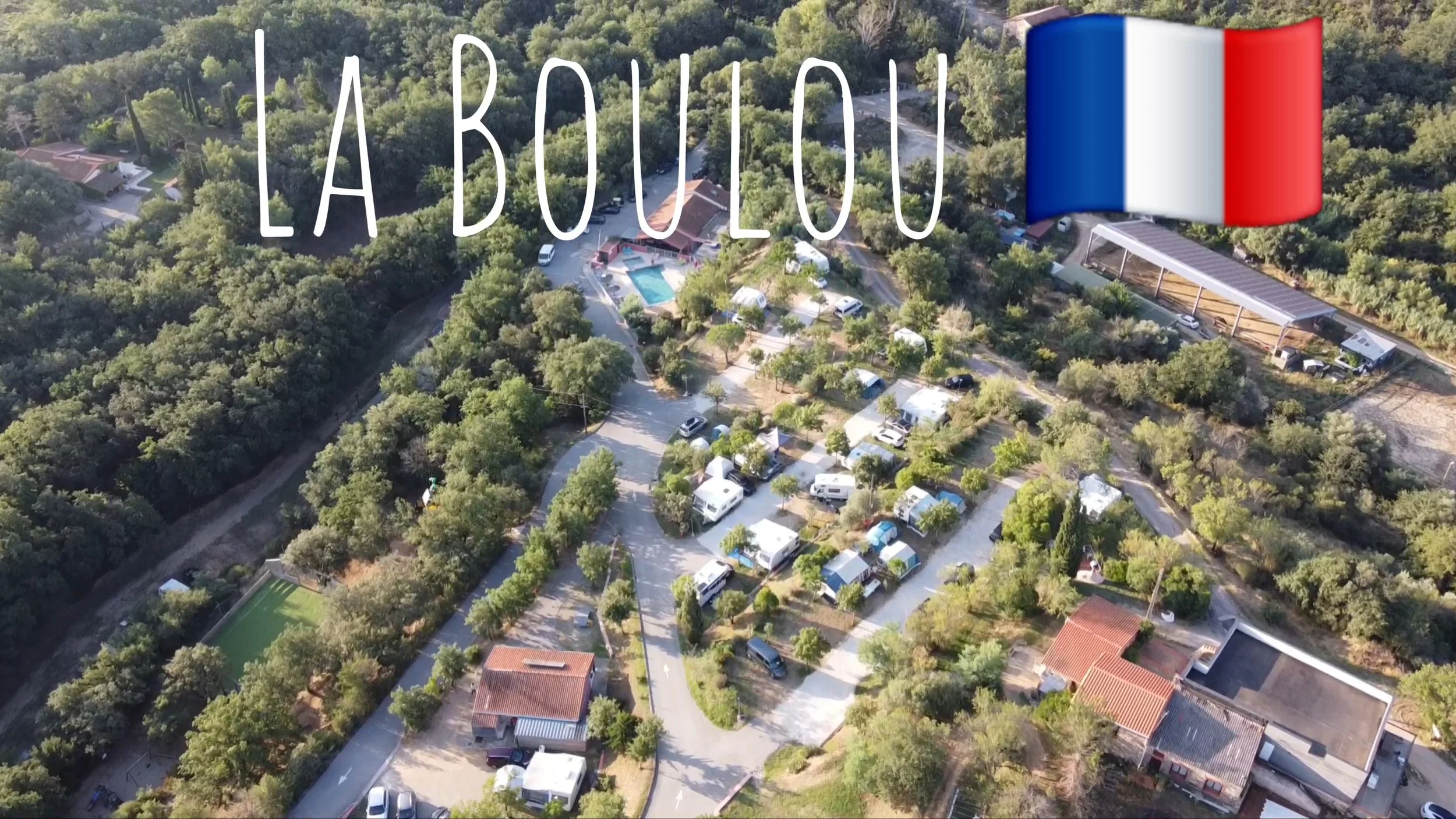
Purpose-built aerial and FPV video packages showcasing campsites, holiday parks, and outdoor destinations. Footage highlights pitch layout, facilities, surroundings, and customer experience — ideal for websites, booking platforms, and social media.
Increases bookings by allowing guests to visualise the experience before arrival.
These are best used throughout the year, showcasing your site in all seasons.
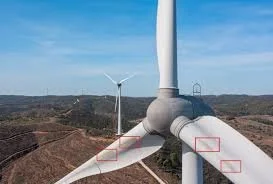
Close-range visual and thermal inspections of wind turbines and industrial structures, including blades, towers, and nacelles. Inspections are carried out safely from stand-off distances, reducing reliance on rope access or shutdowns.
Reduces inspection risk while maintaining asset availability.
From £750 per turbine (Discounted rates available for multiple turbines on the same site)
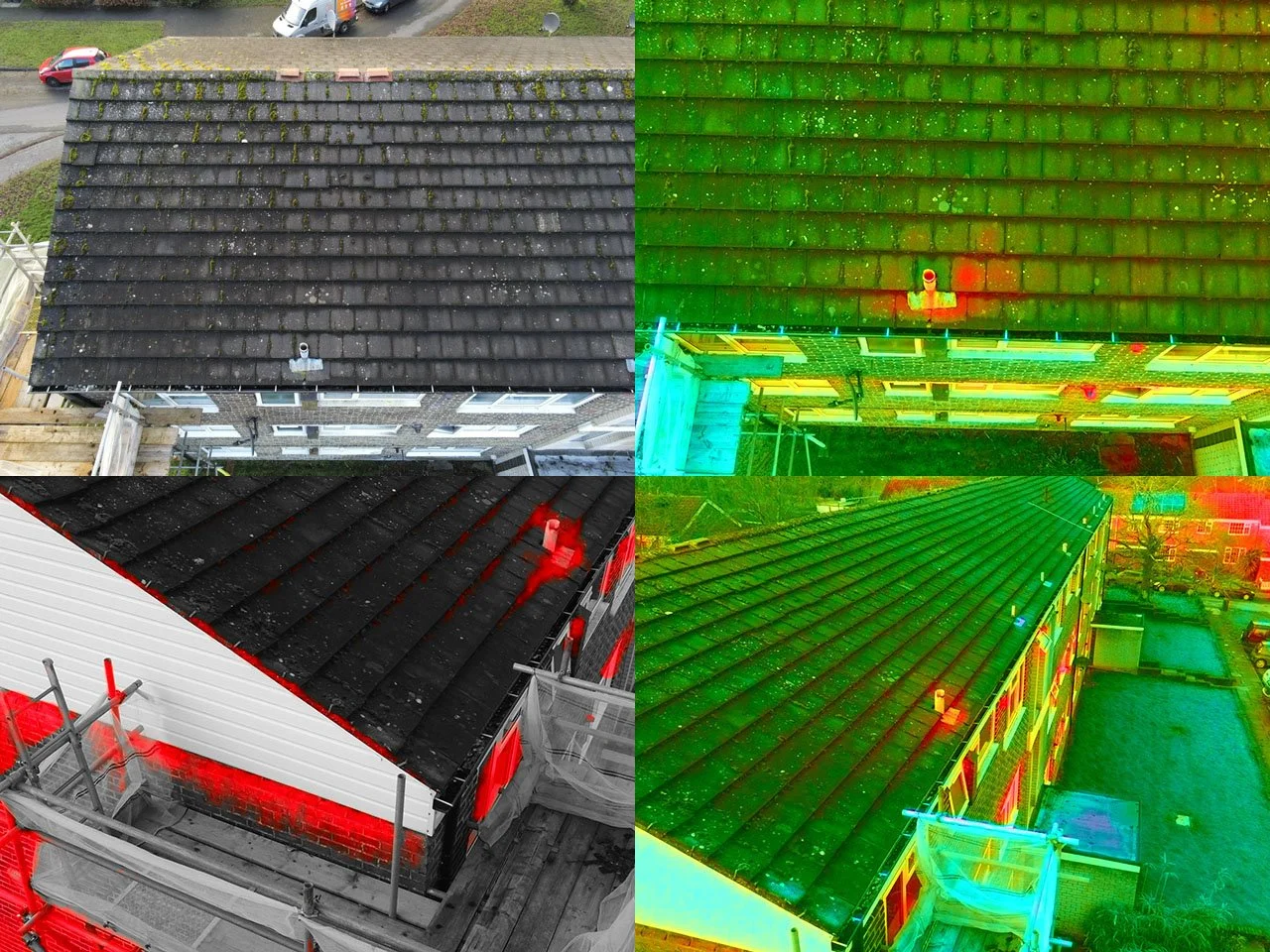
Non-intrusive thermal inspections identify heat loss, insulation defects, and moisture-related anomalies without disruption to occupants or operations. High-resolution thermal imagery provides clear visual evidence to support maintenance planning, energy-efficiency initiatives, and early-stage investigations, including those aligned with housing sector requirements under Awaab’s Law.
Early identification reduces repair costs, tenant complaints, and energy waste.
Entry pricing applies to single, low-rise buildings with a footprint of up to approximately 400 m². Larger or more complex sites are priced proportionately.
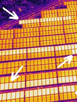
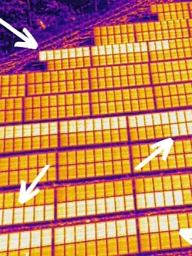
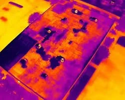
Thermal and visual inspections of photovoltaic systems to identify underperforming panels, electrical faults, and connection issues. Surveys support rapid fault identification, yield protection, and prioritised maintenance without unnecessary downtime.
Entry pricing applies to small solar PV sites (typically up to ~0.75 hectares). Larger sites are priced proportionately.
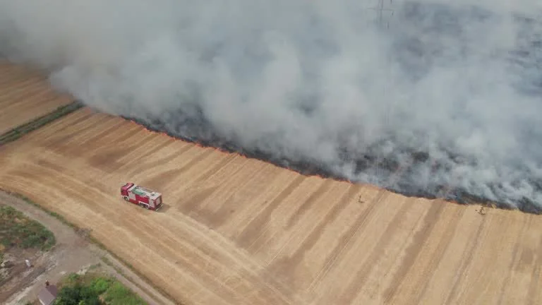
Rapid deployment for post-incident inspections including storm damage, fire impact, structural concerns, and access-restricted sites. Aerial intelligence is delivered quickly to support informed decision-making when time is critical.
Immediate situational awareness without exposing personnel to risk.
Dynamic FPV and cinematic aerial video capturing the scale, flow, and layout of domestic or commercial properties, developments, and operational sites. Designed for marketing, stakeholder engagement, and digital campaigns.
Premium visual content that clearly communicates value and scale.
Entry pricing based on a small commercial unit, café, gym, office suite, or simple internal space requiring a dynamic walkthrough for a website or listing.
Non-intrusive thermal inspections identify heat loss, insulation defects, and moisture-related anomalies without disruption to occupants. Aerial surveys provide clear visual evidence to support damp investigations, maintenance prioritisation, and early-stage assessments aligned with the investigative requirements introduced under Awaab’s Law.
Enables faster, evidence-led response while reducing unnecessary invasive inspections.
Entry pricing is per block - multi-block pricing available.
No results match your search. Try removing a few filters.
