
 Image 1 of 1
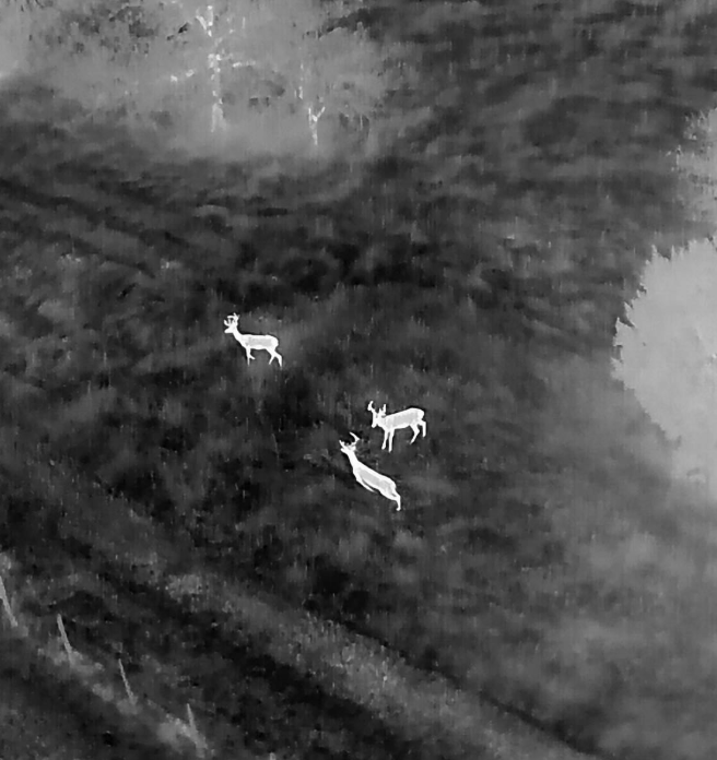
Vista Metrics provides non-invasive thermal drone surveys to support deer population assessment and land-management decision-making across estates, parkland, and managed woodland.
Using early-morning or dusk thermal flights, we help estates build an evidence-based picture of deer presence, relative numbers, and spatial distribution, without disturbance to animals or the public.
Estimated deer count ranges (not absolute claims)
Spatial distribution and movement patterns
Identification of key habitat use and corridors
Annotated thermal and visual imagery
A concise, defensible report suitable for internal use or consultant input
The approach is designed to complement existing deer-management and forestry practices, not replace them.
*Pricing based on 350 Ha site