
Thermal Wildlife & Deer Population Surveys
High-accuracy thermal drone surveys providing independently verifiable deer population data for estates, land managers and conservation authorities.
Used by: Private Estates | National Trust Land | Conservation Managers
Technology: Latest Thermal Imaging drones
Methodology: Block-based aerial census with conservative counting model
Outputs: Survey maps, population tables and management-ready reports
Survey Methodology
Each survey follows a structured methodology designed to maximise detection reliability while avoiding duplicate counts.
1. Survey Block Planning
The estate is divided into defined survey blocks based on landscape features such as woodland boundaries, fields and terrain. This prevents double counting and ensures systematic coverage.
2. Thermal Detection Flights
Thermal drone passes are flown across each block at controlled altitude and speed. Woodland edges, clearings and open fields are scanned for heat signatures consistent with deer.
3. Detection Logging
Every confirmed detection is logged during post-processing and assigned a unique reference. Information recorded includes:
• location
• species (where identifiable)
• group size
• detection confidence
4. Conservative Population Model
Where species or group composition cannot be determined with high confidence, detections are logged as indeterminable rather than assumed. This ensures that final population figures remain defensible and conservative.
Why Thermal Drone Surveys Are Effective
Traditional deer counts are often limited by poor visibility, woodland cover and observer bias. Thermal drone surveys provide a more systematic and evidence-based alternative.
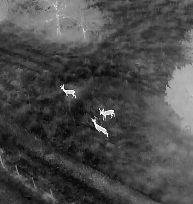
Thermal sensors detect body heat, allowing animals to be identified even when partially obscured by vegetation or hidden within woodland edges.
Because imagery is recorded during the survey, detections can be reviewed and verified afterwards, providing a permanent visual record of observations.
This approach allows large areas to be surveyed quickly while maintaining a structured and defensible methodology.
Key advantages
• Detects animals using body heat rather than visual sighting
• Allows large estates to be surveyed efficiently
• Reduces observer bias and missed animals
• Creates permanent recorded evidence of detections
• Supports repeatable monitoring over time
Example Survey Outputs
Below are examples of surveys conducted on large UK estates using thermal drone census methodology.
Studley Royal Estate Survey
Location: Studley Royal Estate
Survey Area: Approximately 800 acres
Method: Thermal aerial census using block-based survey design
The survey identified multiple roe and fallow deer detections across woodland blocks and open pasture. Thermal imaging allowed animals to be located within woodland edges and partially covered vegetation.
Outputs delivered
• Detection location mapping
• Population summary tables
• Annotated imagery examples
• Formal survey report for estate management use
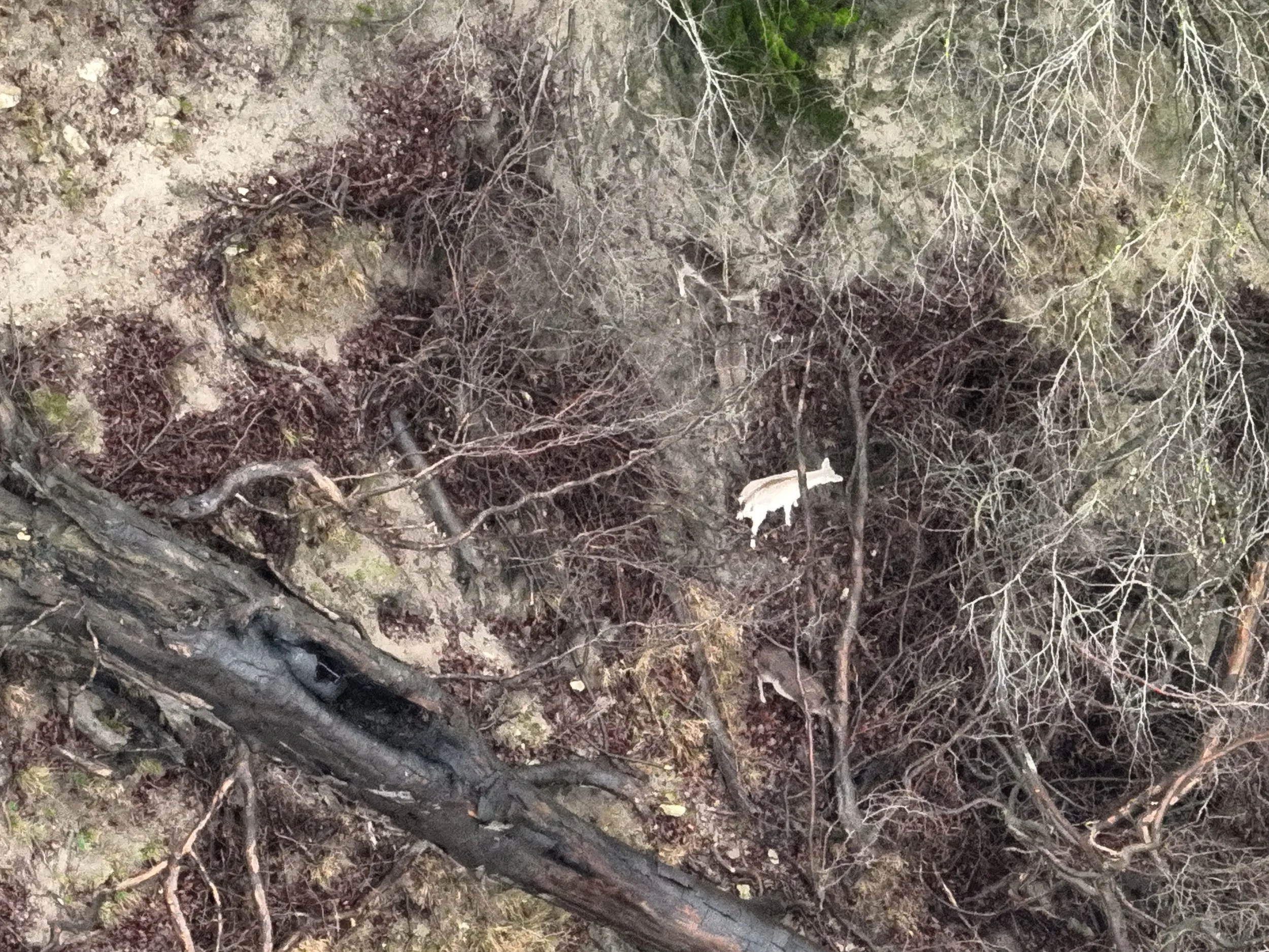
Thermal imaging detected 2 roe deer in dense woodland. Look at the next video to see just how dense this woodland was!
If you were using a regular, RGB only drone for population surveys, this is what you would have seen!

Hopetoun Estate Survey
Location: Hopetoun Estate, Scotland
Survey Area: 861 hectares (Home Beat survey block)
Method: Structured thermal drone census
The survey recorded multiple roe, fallow and red deer detections across woodland and open land blocks.
Thermal imagery enabled identification of individual animals within woodland areas that would have been difficult to detect using ground-based methods.
Outputs delivered
• Block-based detection mapping
• Population estimate tables
• Example thermal imagery
• Management-ready survey report
Survey Deliverables
Each survey produces a structured set of outputs suitable for estate management, ecological consultants and land management reporting.
Deliverables typically include:
• Deer population summary tables
• Detection location maps
• Annotated thermal imagery
• Survey methodology documentation
• Species identification notes
• Management-ready survey report
Data formats can also be supplied for integration with ecological reports or land management documentation.
Management Applications
Thermal population surveys provide valuable evidence for a range of land management activities.
Typical uses include:
• deer population monitoring
• habitat impact assessment
• cull planning support
• supporting deer management plans
• evidence for grant-funded management schemes
• long-term population monitoring
Repeat surveys can be conducted annually or seasonally to track changes in population size and distribution.
Operational Standards
Vista Metrics operates to professional commercial drone standards.
• UK CAA Operational Authorisation (PDRA-01)
• Commercial drone insurance
• Structured risk assessment and flight planning
• Professional reporting standards
• Evidence-based survey methodology
All flights are conducted in accordance with UK aviation regulations and site-specific risk assessments.
The British Deer Society has highlighted the growing use of drones to support deer survey and management in the UK (https://bds.org.uk/2023/08/14/drones-helping-to-count-survey-deer-uk/).
Government Policy & Evidence-Based Deer Management
Government policy in England now places strong emphasis on accurate monitoring of deer populations to support woodland protection, biodiversity recovery and land management.
According to the UK Government’s Deer Impacts Policy Statement:
“Improving the evidence base on deer distribution, density and impacts is essential to effective deer management.”
This reflects a growing recognition that deer populations have expanded significantly across the UK.
Recent evidence suggests:
“Approximately one third (33%) of English woodlands are negatively impacted by deer.”
As a result, government policy now prioritises data-led management at landscape scale, supported by improved monitoring and reporting.
The Shift Toward Evidence-Based Monitoring
Government guidance increasingly emphasises three core requirements for effective deer management:
Reliable population data
“Improved data collection on deer distribution, density and impacts is a foundation of the strategy.”
Land managers are expected to base decisions on credible population estimates rather than anecdotal sightings.
Landscape-scale monitoring
Deer populations move across estate boundaries, meaning monitoring is increasingly expected to occur at landscape scale rather than single properties.
This requires survey methods capable of covering large areas efficiently and consistently.
Independent evidence
For many funding schemes and management plans, authorities expect objective evidence that can support management decisions.
Independent surveys provide:
defensible population estimates
spatial mapping of deer activity
baseline data for long-term monitoring
supporting evidence for grant applications
How Vista Metrics Supports This
Vista Metrics provides independent thermal aerial deer surveys designed to produce the kind of evidence-based population data required by government policy.
Using high-resolution thermal sensors and structured block-based survey methods, surveys can:
detect deer across woodland and open ground
record geolocated detections across the estate
produce defensible population estimates
generate mapped outputs suitable for management plans
The result is a clear and independent evidence base that can support:
Deer Management Plans
Forestry Grant Scheme applications
Woodland creation funding
Long-term population monitoring
Policy Requirement
“The Deer Management Plan must be based on an accurate, independent third-party assessment of deer densities.”